Plotting Safe Courses for Autonomous Vessels
Robotic and Autonomous systems are being used to map efficient and safe paths for autonomous vessels, moving technology toward the potential for self-navigating vessels.
Autonomous Vessels of the Future:
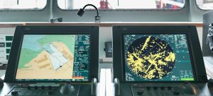
The use of autonomous technology in the maritime industry is increasing and as a result the safety implications for seafarers, cargo and vessels are the latest discussion subject at the ADMIRALTY event at London International Shipping Week (LISW) 2023. As the world moves towards fully autonomous ships, the traditional method of humans on board using standard digital products will no longer be applicable. The current navigation methods using Electronic Navigational Charts (ENC) are optimised for human interpretation, which presents a challenge for the industry. The UKHO are supporting development of machine-readable navigational solutions that support uncrewed Maritime Autonomous Surface Ships (MASS). This solution will support the next generation of navigational products and services for large ocean-going autonomous vessels.
Recent USV Surveys:
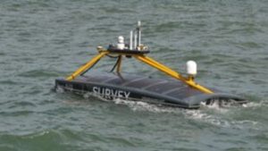
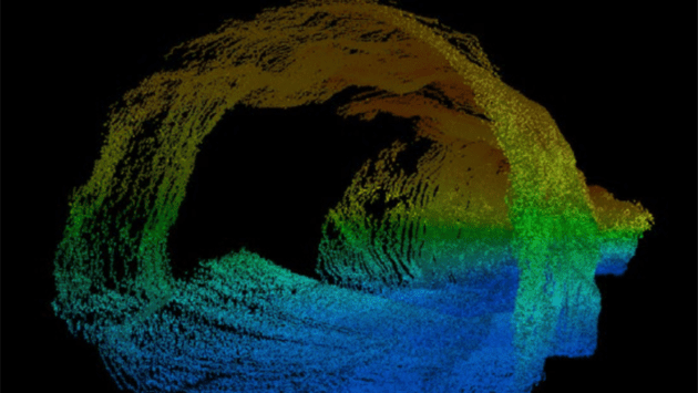
XOCEAN recently deployed five Uncrewed Surface Vessels (USVs) off the Isles of Scilly to collect bathymetric data on behalf of the UK Hydrographic Office (UKHO). The USVs conducted a series of scans along the seabed to help identify features from depths and habitats to ridges, boulders, and shipwrecks. This mission was the first time the UKHO had commissioned an organisation under their framework to collect data using uncrewed vessels. The USV pilots and surveyors conducted the missions from the shoreline and monitored the progress via satellite communications.
XOCEAN used the UKHO’s ADMIRALTY ENC’s to safely navigate the USVs whilst collecting the bathymetric data. The data collected by XOCEAN enabled the UKHO to map the seabed and provide a better understanding of the seafloor and the marine environment to support efficient and safer maritime navigation. The XOCEAN project demonstrated when the data is integrated with other existing data collections, the gridded bathymetry can significantly contribute to navigation and position determination for MASS.
Digital Twin Technology:
The UKHO is also assisting the development of digital twin technology for the future of autonomous ships. A digital twin is a virtual representation of a physical setting, precisely mirroring its conditions in near real-time. These digital duplicates can be used in various applications such as enabling users to undertake virtual tours of ports, informing data gathering and supporting route optimisation and simulation. The real-time data feeds and AI test data are used to display live vessel movements. This process encompasses official marine data such as bathymetry, tidal heights, and seabed configurations, which serves as a bridge between scientific knowledge and decision-making.
This technology will foster innovation in the maritime sector by creating a lifelike environment to simulate a variety of scenarios that a mariner could feasibly encounter at sea. It will also enable the testing of new technologies for both crewed and uncrewed vessels and for researchers to study the effects of environmental change. The digital twin technology provides an accurate environment to simulate scenarios to enable innovation across the maritime industry.
By using the same 3D engines that power video games, the UKHO teams have also been able to successfully develop dynamic digital models of the coastline and its associated features to support MASS. This technology has recently developed ‘digital twins’ of port environments, including Southampton and north-west Scotland, using a similar concept. These technologies could potentially serve as a robust tool for MASS navigation in coastal regions. With every research and trial project conducted, the industry moves closer to unlocking the potential of self-navigating vessels. And as the industry heads towards an exciting new chapter for shipping, the project teams will continue to collaborate to support safe navigation for the autonomous vessels.
Read More:
Plotting a safe course for autonomous vessels
Teledyne Marine Slocum Glider Overview
UK Hydrographic Office: Digital Twin Video
ADMIRALTY Vector Chart Service
