From Shipwrecks to Shorelines: The Multi-Disciplinary Power of StarFish Side Scan Sonar
From shallow water environmental surveys to deepwater archaeological exploration
Blueprint Subsea’s ‘StarFish’ side scan sonar delivers high-resolution, compact underwater imaging that’s redefining shallow water survey capabilities for marine professionals worldwide. Side scan sonar is a specialised underwater imaging technology, it offers a fast, efficient, and non-invasive way to visualise and map the seafloor and submerged objects—especially in environments where visibility is poor or access is limited.
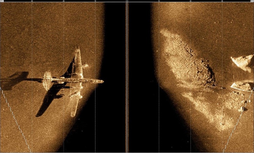
A sonar device functions by emitting fan-shaped sound pulses outward from both sides of a transducer. These sound waves bounce off the seafloor and any objects they encounter. The intensity of the returning echoes is recorded by the sonar to build a grayscale image. Hard surfaces (like rocks or wrecks) reflect strong signals and appear dark. Soft surfaces (like mud or sand) reflect weak signals and appear light. As the vessel moves forward, the sonar sweeps the seafloor in strips, stitching together a wide, continuous image of the underwater landscape.
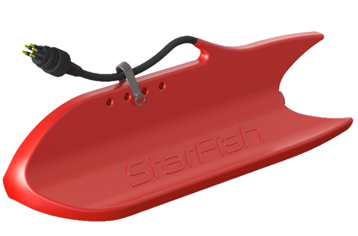
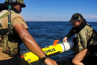
Built with versatility in mind, the StarFish can be towed, and hull mounted offering up to 50m depth rating for shallow water work or integrated into OEM AUVs and ROVs with a 2000m depth rating for survey work. They offer exceptional image clarity using CHIRP technology, with 450kHz providing increased range and 1MHz delivering enhanced resolution. Engineered for single-person rapid deployment, the StarFish range deliver 200m swath coverage and intuitive operation—making them ideal for a wide range of marine operations.
Its high-resolution capabilities make it particularly effective in mapping and survey work, where it supports environmental monitoring by capturing detailed images of benthic habitats, sediment distribution, and coastal topography. This data is crucial for habitat conservation, shoreline management, and infrastructure planning in coastal engineering projects.
In search and recovery (SAR) missions, StarFish proves invaluable to rescue teams and law enforcement agencies. Its ability to detect and visualise submerged vehicles, debris, and forensic evidence in murky and low-visibility waters allows for rapid and accurate response in time-sensitive scenarios. The sonar’s clarity and wide swath coverage reduce search times and improve operational safety.
Underwater archaeologists rely on StarFish to identify, and document submerged cultural heritage sites, including shipwrecks, ancient settlements, and lost artifacts. Its non-invasive imaging approach preserves delicate structures while providing researchers with the spatial context needed for historical interpretation and conservation planning.
In marine construction and inspection, StarFish supports both pre-construction site assessments and post-installation evaluations of underwater infrastructure such as pipelines, cables, and foundations. Its precise imaging helps engineers detect anomalies, monitor structural integrity, and ensure compliance with environmental regulations.
Beyond professional use, StarFish’s lightweight design and intuitive software interface make it accessible to universities, citizen scientists, and recreational users. Whether deployed from a small research vessel or used in academic fieldwork, it offers an affordable entry point into marine exploration, fostering education and innovation in ocean science.
For more information on the Starfish Side Scan Sonars, please Contact the BlueZone Group sales team.
Read More:
Blueprint Subsea StarFish Range

StarFish (Towfish) (Photo credit: Blueprint Subsea).

Side Scan Sonar Image (Photo credit: Blueprint Subsea).


